Over the years, our lab has established numerous fruitful collaborations with research and development institutions both in Brazil and abroad. These valuable partnerships have resulted in a wide range of joint publications, successful projects, and productive exchanges of researchers.
Additionally, LFSR has welcomed researchers from partner institutions as esteemed external collaborators, whose basic profiles are available under "team".
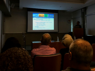
Below, we present a concise yet inclusive compilation of our major partnerships to date.
 |
Since its establishment in 2014, our enduring partnership with the Universitat Politècnica de Valencia and its program of Cartographic, Geodetic and Photogrammetric Engineering, has been marked by consistent renewal and collaborative achievements. As a partner of GIFLE (Grupo de Investigación en Fotogrametría y Láser Escáner), which translates to "Research Group in Photogrammetry and Laser Scanning" in Spanish, our lab has actively engaged in research on close-range photogrammetry and LiDAR technologies. |
 |
In 2019, we forged a partnership with the Universidade Federal do Rio de Janeiro (Federal University of Rio de Janeiro), collaborating closely with SIGEURB (in Portuguese, "Laboratório de Sistemas de Informação Geográfica Aplicados à Engenharia Urbana" - Laboratory of Geographic Information Systems applied to Urban Engineering), a member of the Polytechnic School and of the Postgraduate Program of Urban Engineering. With our partners at UFRJ, we develop mostly studies on Photogrammetry and Remote Sensing for Earth Observation, with a special focus on Urban Planning. |
 |
A recent addition to our portfolio of collaborations has been with ENGAGE - Geomorphological Systems and Risk Research, a group of the Department of Geography and Regional Research of the University of Vienna. LFSR has contributed to a joint project, called RioSlide, which aims to integrate dynamic and static modeling to integrate landslide susceptibility and critical rainfall conditions in Rio de Janeiro, within our line of research entitled "Photogrammetry and Remote Sensing for Earth Observation." |
 |
We have also benefitted from a long-standing partnership with Instituto Militar de Engenharia and its Imaging Lab at the Program of Cartographic Engineering. Recent joint research has dealt mostly with the use of photogrammetric and LiDAR data for feature extraction and other applications of Earth Observation. |
 |
Instituto Municipal de Urbanismo Pereira Passos (Pereira Passos Municipal Institute of Urban Planning) has been our major source of imagery and geospatial data for the city of Rio de Janeiro. As the municipality's planning and research institute, IPP has been a major partner of LFSR since its inception, in 2002. The laboratory has also produced joint research with the institute's City Information Coordination, most notably on photogrammetric and laser scanning techniques for cadastral surveys, a branch of our line of research broadly defined as "Photogrammetry and Remote Sensing for Earth Observation." |
 |
Diretoria do Serviço Geográfico do Exército Brasileiro (the Brazilian Army's Geographic Service) has also been an important source of geospatial data for the country. Our lab's partnership with DSG started in 2009, and involved primarily our line of research called "Software Development in Photogrammetry and Remote Sensing". e-foto's aerotriangulation module was co-sponsored by DSG. |
 |
Since 2023, LFSR has also partnered with the Laboratory of Epidemiology of Congenital Malformations (LEMC) of the Instituto Oswaldo Cruz (IOC/Fiocruz) in the development of low-cost photogrammetric solutions for the assessment of facial asymmetries. |
 |
Instituto Mapear has played a crucial role as an industry partner through its collaboration on joint studies with our team. These studies primarily focus on enhancing the methodology and accuracy of photogrammetric and vector acquisition procedures, specifically related to aerial and orbital images for large-scale mapping purposes. Our partnership with Instituto Mapear places a significant emphasis on the multipurpose municipal cadastre, ensuring comprehensive and reliable mapping solutions. |
 |
The Brito Research Group is an interdisciplinary research team studying ecological interactions across various ecosystems, with a focus on how landscapes influence these dynamics. The group aims to understand how species interact with each other and with their environment, analyzing biological components and spatial characteristics of the surrounding landscape. They seek to understand how the spatial configuration of habitats and vegetation mosaics affects biodiversity and ecosystem services. This research group is funded by FAPERJ and the Serrapilheira Institute and works in partnership with the Laboratory of Ecology and Ecosystem Conservation (LECE) at UERJ, which is dedicated to studying ecological processes and developing strategies for environmental conservation. |